EXPLORE THE RIVER

From wetlands packed with wildlife and beautiful scenic overlooks to bustling city centers located along the river’s edge, the Missouri’s banks are home to dozens of places to see and things to do.
Explore our list to get a sampling of what’s out there.
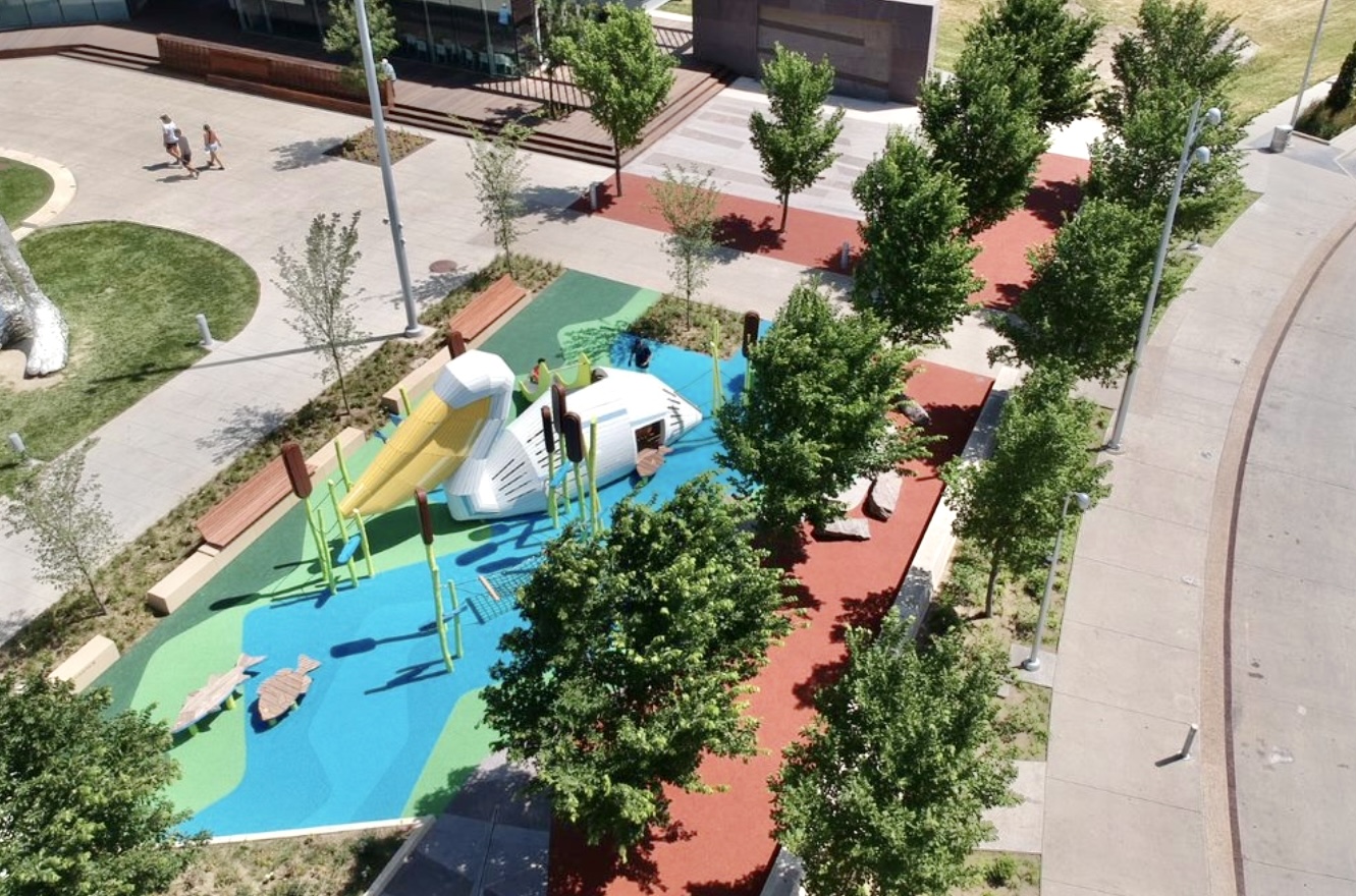
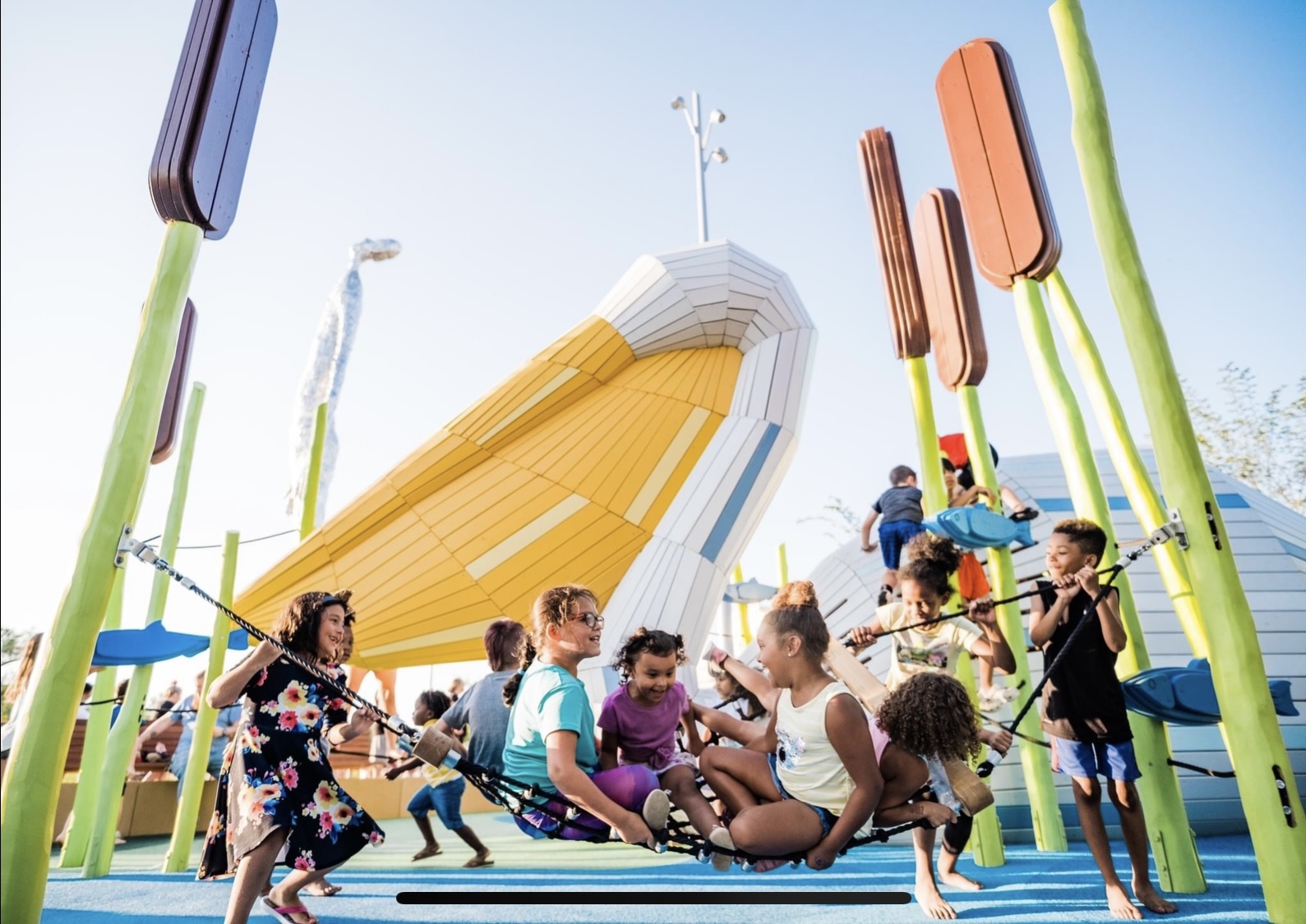
Located in Tom Hanafan River’s Edge Park, this attraction features a colorful, 15-foot-tall pelican landed next to the River’s Edge Pavilion! This pelican features climbing structures, a slide, a hammock and a lookout perch. Its new home is called Belles’ Play Garden. Encompassing over 2,000-square-feet, the Play Garden also includes a series of Missouri River-inspired play and educational elements, interpretive seating, and rich native plantings. Since its opening, children and young families have made Belles Play Garden on of the Riverfront’s most popular spots.
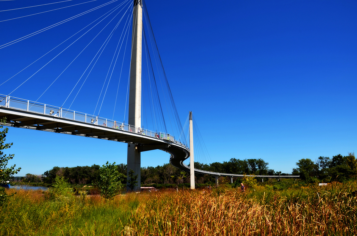
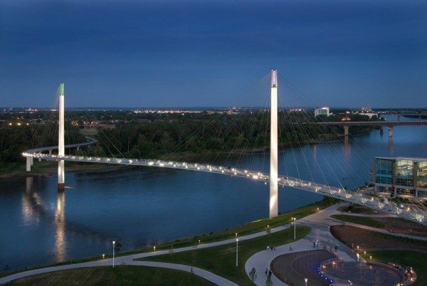
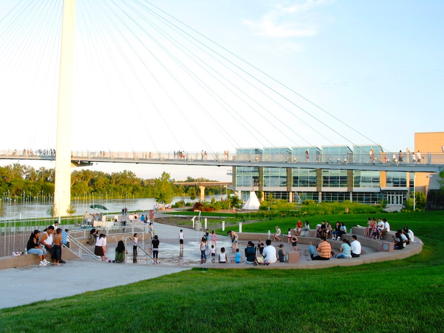
Opened to the public on September 28, 2008, the Bob Kerrey Pedestrian Bridge is defined by twin spires reaching 200 feet into the sky, representing the connection between the cities of Council Bluffs and Omaha. The graceful curved design of the bridge – named by Travel+Leisure magazine as one of the world’s most beautiful pedestrian bridges – reflects the elegance of the water that rushes below. At night, the twin spires and graceful cable stays light up the Missouri River for miles.
The landmark showcases the trail access, wildlife and compatible economic development that is possible along the Missouri River. Walkers, bikers, joggers, birdwatchers and others can traverse the 3,70o-foot span, which connects nearly 150 miles of trails in both Iowa and Nebraska.
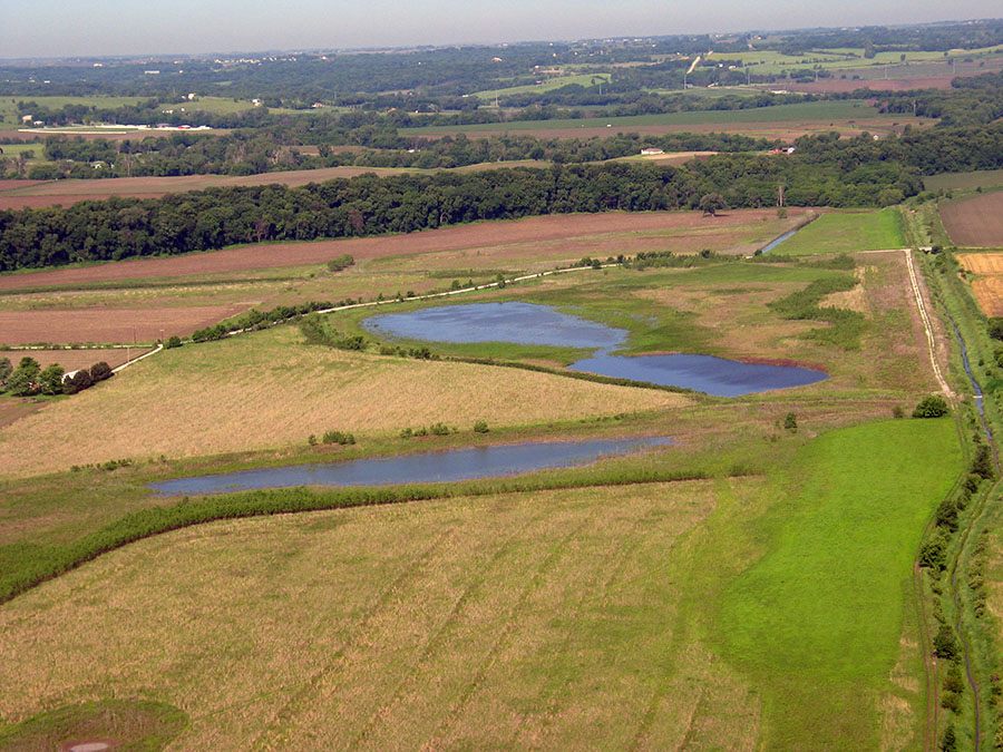
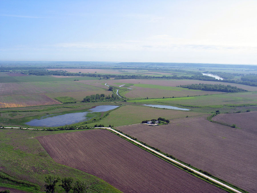
Boyer Chute National Wildlife Refuge is currently over 4,000 acres in size and is directly east of Ft. Calhoun, Nebraska, or five miles north of the Douglas/Washington County line along the river road. This site was established over two decades ago with initial acquisitions of nearly 2,000 acres by the Papio-Missouri River Natural Resources District. Subsequent acquisitions adjacent to the original 2,000 acres, totaling another 650 acres, were accomplished by the NRD and similarly donated to the U.S. Fish and Wildlife Service.
The restoration of the historic Boyer Chute, a three-mile natural cutoff of the Missouri River, occurred in 1992/93 with the assistance of the Corps of Engineers. The NRD provided public access roads, fishing sites and prairie/tree planting. Several years following the development of the site, the NRD gave the entire area to the U.S. Fish and Wildlife Service to be operated under their Refuge System umbrella. While the site was devastated by the 2011 flooding, sufficient vehicle/bike access has been provided for the public to utilize the area for fishing and low impact recreation. The site is open to the public free of charge. Specific information as to hours, uses, etc. can be found at fws.gov/refuge/boyer_chute/.
Boyer Chute Expansion is an additional 650 acres south of and adjacent to the original Boyer Chute NWR in Washington County. It includes the site locally known as Nathan’s Lake – a Missouri River wetland that was acquired and restored by the NRD, the Nebraska Environmental Trust and the COE. Once the restoration was completed, it was subsequently donated to the U.S. Fish and Wildlife Service as a part of their existing Boyer Chute NWR. There is limited access to the site since parking is not available, and the site is bisected by County Road P-51. The 2011 flooding did not appear to negatively impact the wetlands. Its location is approximately four miles north of the Douglas/Washington county line along the river road (County Road P-51). It is also depicted on the brochure at: www.fws.gov/refuge/boyer-chute/.
Numerous other tracts have been acquired within the authorized (potentially over 10,000 acres) Refuge Boundary by the U.S. Fish and Wildlife Service over the years to amass the current 4,000 plus acres.
California Bend is a 215-acre site owned by the Papio-Missouri River Natural Resources District that is adjacent to the north end of Blair, Nebraska along the Missouri River. It was a planned Missouri River Habitat Restoration Project with a “California Bend Recreation & Habitat Master Plan” that was developed with the City of Blair. The planned Habitat Restoration work was completed in cooperation with the Corps of Engineers and additional funding from the Nebraska Environmental Trust. However, before the public access plan was initiated, to have included Two Overlooks, a Paved Trail and Fishing Access Sites, the 2011 flood filled the restored chutes with sand/sediment and virtually destroyed the site’s off-channel benefits. This is a “Future Project” to again restore the Habitat Restoration benefits and incorporate the public use aspects. The site remains closed to the public, yet continues to provide primarily terrestrial wildlife benefits.
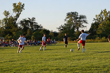
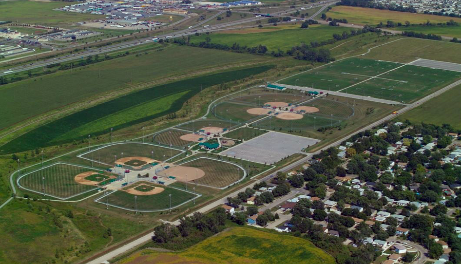
Located just off the Missouri River at 2900 Richard Downing Avenue, the Council Bluffs Recreation Complex provides a tournament-quality facility for baseball, softball, soccer and football. It is one of the finest facilities of its kind in the Midwest.
In deciding to construct a facility of this size and quality, the City considered that meeting both the residents’ needs for fields and positioning Council Bluffs to attract major regional/national tournaments and competitions was important. Today, the Complex illustrates that local recreational needs can be met while still hosting events that positively impact the City’s economy.
The design, operation and maintenance of the Council Bluffs Recreation Complex is a point of pride for the City and its residents. In fact, the Complex has been selected as the “Field of the Year” by Iowa Turf associations.
Elements of the Council Bluffs Recreation Complex include:
- Host site for Council Bluffs and Omaha leagues, plus local, district, state, regional, and national tournaments
- 4 softball fields, 4 baseball diamonds, and 2 youth/fast pitch fields
- 10 full-size soccer fields with goals for soccer age groups 6 and under to 13 and under
- 4 full-size Football fields with goal post and electronic Scoreboards
- Two full-service concession areas with outdoor seating
- Tournament/Conference Room
- Large playground
- Paved concrete bike trail (Connects To City Wide Trail System)
- Easy access from Interstates 29, Interstate 80 and Veterans Memorial Highway
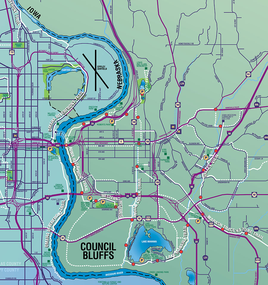
One of the best ways to experience the beauty and power of the Missouri River would be traveling the City’s trail system. Pedestrians and cyclists from both sides of the river come to Council Bluffs simply for the expansive trail network. Some of the most beautiful views of the Missouri River are along the 13-mile stretch of Riverfront trail. Recreational travelers exploring the ribbon of riparian woodlands will encounter Big Lake Park, Tom Hanafan River’s Edge Park, the Bob Kerrey Pedestrian Bridge, Dodge Riverside Golf Club, Harrah’s and Ameristar Casinos, Western Historic Trails Center, and the City’s Recreational Complex before arriving to Lake Manawa.
These pedestrian byways have played an important role in the health and wellness of the community of Council Bluffs. Throughout the City there are over 40 miles of trails designed to provide physical activity and recreational opportunity for all ages. This expansive network provides vital connections through the social fabric, connecting locals and attracting visitors to community events and regional attractions. The trail system has been seen as an essential element in community development, connecting the ecological richness of the riverfront to historical urban areas of downtown. There are very few areas a pedestrian or bicyclist can’t get to through this vast network.
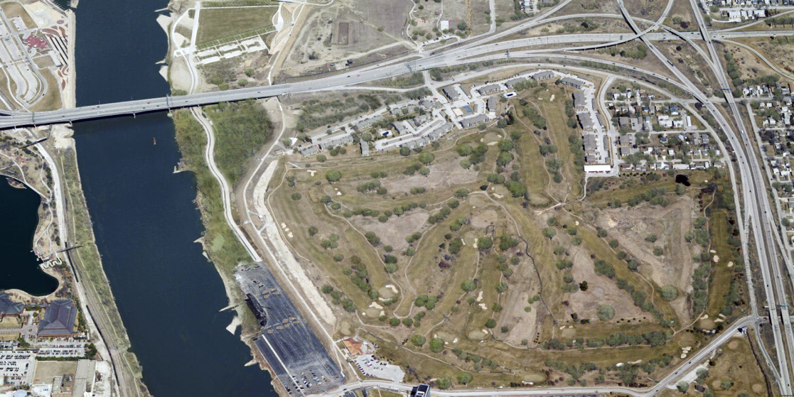
Dodge Riverside Golf Club is an 18-hole championship course with year-round and programs for both new and experienced golfers. The location is just one of Dodge Riverside Golf Club’s many assets, directly across the street from Harrah’s Casino Hotel. Golfers will enjoy the beauty of the golf course as well as the Missouri River and downtown Omaha landscape. Established in 1927, Dodge is one of the oldest courses in the metro area and is owned and operated by the City of Council Bluffs. A major renovation project in 1996 has complemented the course’s mature tree-lined fairways with some of the best greens in the area. A new irrigation and drainage system assures players that the course will be in good condition no matter what time during the golf season it is. Dodge Riverside will give golfers of any skill level a challenge. In 2008 Dodge Riverside Golf Club was named to the Golf Digest list of best places to play.
Dodge Riverside Golf Club caters to a wide variety of golfers. The course hosts about 300 league players weekly and about 50 to 60 outings and tournaments yearly. Dodge Riverside also accommodates the local High School golf teams for their practices and invitationals. The clubhouse is also the location of Caddy’s Riverside Grille – a full-service restaurant and bar with unparalleled views of the Missouri River and downtown Omaha. With plentiful indoor seating, patio seating and a private dining room, the Grille can accommodate every need, from family brunch to an after-golf snack, to wedding receptions. Just a half-mile south of the new Bob Kerrey Pedestrian Bridge, Caddy’s Riverside Grille is also a great stopover for those who utilize the bike and walking trail that is located just alongside the facility.
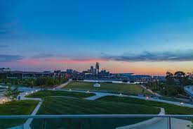
As Downtown Omaha expands and renewed attention is paid to the potential of our riverfront, city leaders are working with nonprofit Heritage Services to develop a plan for continued development. Their goal is to increase riverfront access, foster activities, encourage additional events and add features like restaurants, bike rentals, public pavilions and more.
Positioned perpendicular to the Missouri River in downtown Omaha, the Gene Leahy Mall features a pond bordered by trees and rocks that offers a visual connection to the river, as well as waterfalls, slides and an outdoor amphitheater.
Located within Fontenelle Forest, Hidden Lake offers a 3.4-mile hiking loop that curves around two crystal-clear lakes, ending at an old trading post. The area’s Great Marsh ecosystem, once threatened by heavy soil erosion, has been saved through a series of erosion control efforts over the past few years.
The 27-mile-long Keystone Trail runs from 88th and Fort Streets on the northwest side of Omaha, along the Little Papillion Creek, and ends at Cornhusker Highway. It then loops northward toward Haworth Park, which runs along the Missouri.
Popular among birdwatchers, the Krimlofski Tract is a large swatch of bottomland forest located in Washington County – just beyond the main road to Neale Woods Nature Center.
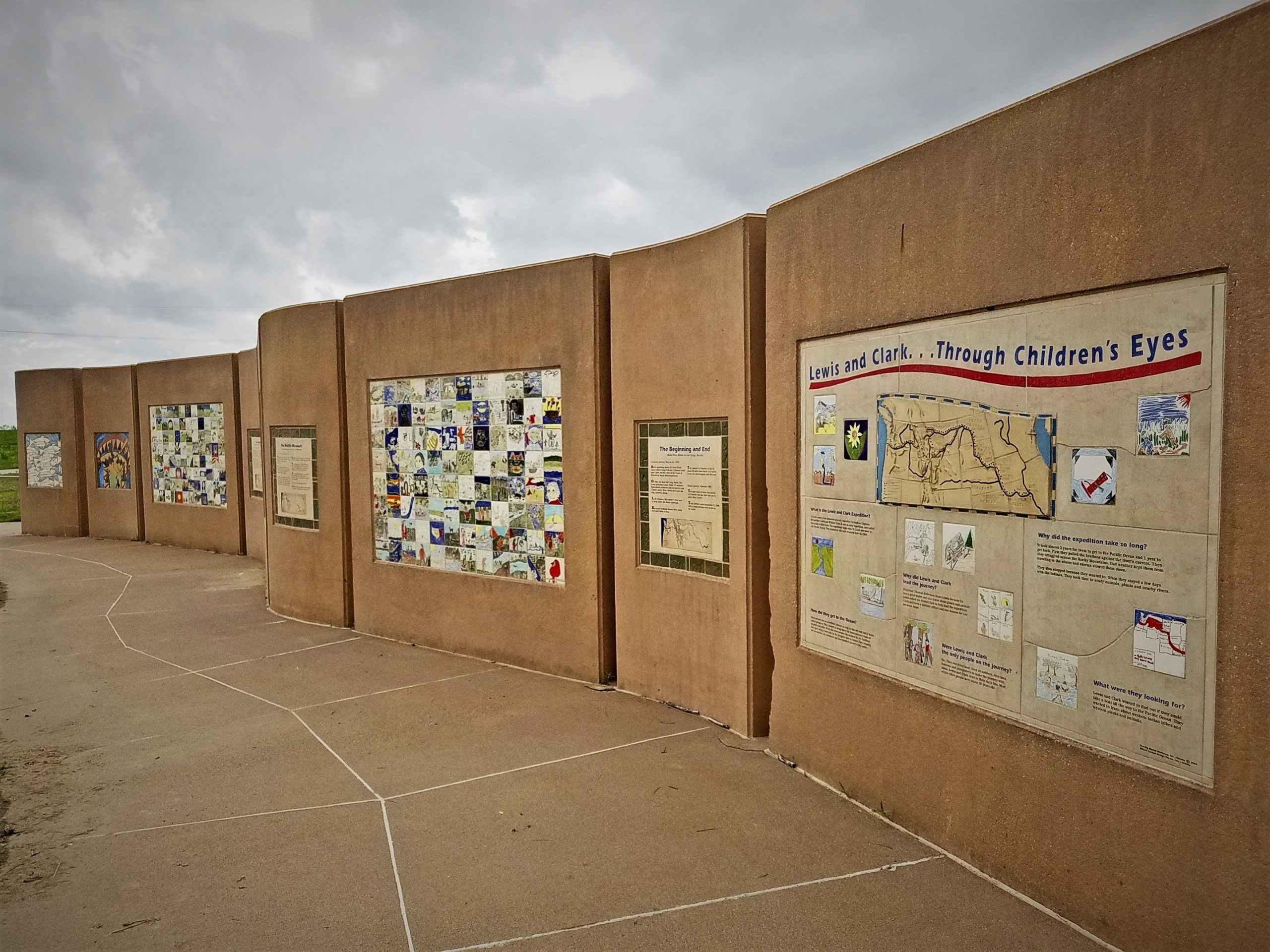
The Children’s Wall is an interpretative art piece constructed in Bellevue’s Haworth Park. The art work was contributed by elementary school students in communities along the routes of the Lewis and Clark expedition. Each student’s work was reproduced on tiles and arranged geographically from Illinois to Oregon. The wall is comprised of 750 of these tiles. It stands 8 foot high and is 65 feet long.
Completion of the Children’s Wall highlighted Sarpy County’s Lewis & Clark Bicentennial celebration.
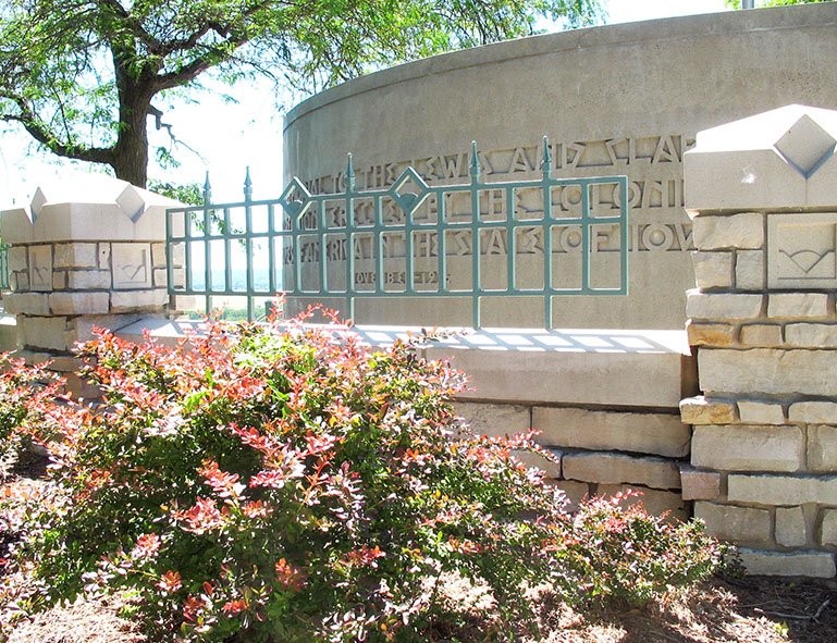
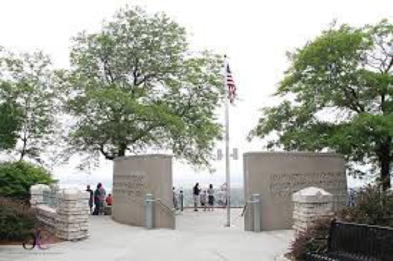
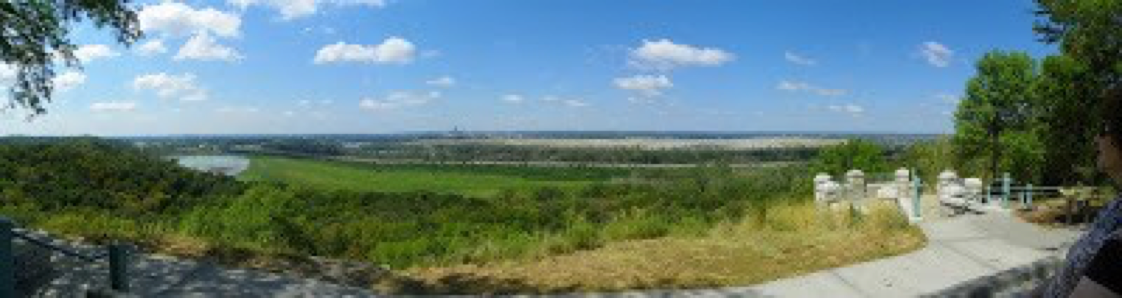
Located at one of the highest points in the Loess Hills, with sweeping views of the Missouri River valley in the distance, the refurbished monument of Lewis and Clark resides. This scenic overlook provides a rare panorama of the distinct contours unique to this region’s topography, highlighted with the shimmering light reflecting from the waves of the Missouri River in the distance. Respectful and reflective, this monument honors the expedition of Lewis and Clark in 1804 and the historic meeting with the Otoe and Missouri Indians. The artwork offers viewers a sense of these historic events that shaped this community. Dedicated in 1936, with renovations of the overlook competed in 2002, this landmark now is a source of community pride.
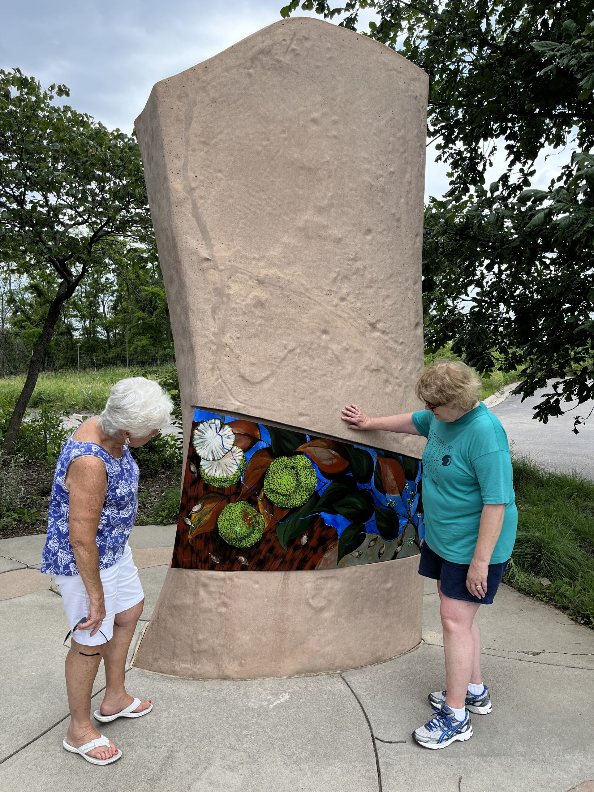
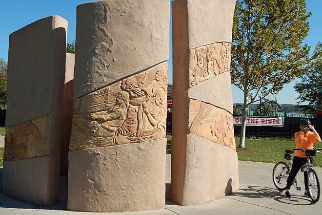
Planning began by identifying river locations to help “tell the story” of Lewis & Clark’s visit. At each location, a large, artist designed, 12 foot high, precast monument was erected. For each monument, a different local artist was then selected to incorporate original art into the monument’s banner area. Many of the artists engaged with local groups, including schools, in planning their art. As a result, each monument is unique, both in size and subject.
Monuments are located at Miller’s Landing Park, Boyer Chute, Lewis & Clark Park, Dodge Riverside Golf Course, Levi Carter Park, Haworth Park, the Western Historic Trial Center, Lewis & Clark Landing and Lauritzen Gardens.
Mandan Park is located in South Omaha, at the extreme southeast corner of Douglas County. The park’s 10.9 acres overlook the Missouri River.
Located on the banks of the Missouri, Miller’s landing is a park featuring Lewis & Clark interpretive exhibits, walking trails and a picnic shelter overlooking the adjoining lake. The park can be reserved for private functions and public events.
The Missouri River Research Station will be the second within the network of aquatic field stations within the Omaha area. Like the original station, the Elkhorn River Research Station, the MRRS will contain aquatic mesocosms that will allow organisms, such as fish and aquatic insects, to be exposed to river water onsite, in realtime and under natural conditions. In addition, the MRRS will also provide continuous reading of water quality parameters, including water temperature, pH, turbidity and dissolved oxygen. In addition to its research capacity, the MRRS is intended to play a vital role in outreach and education with respect to the Missouri River and its impact on Omaha and surrounding communities. It is anticipated that the MRRS will become a destination spot for those interested in the the ecology of the Missouri River and its interconnectivity with the local community.
Perched on a Missouri River Bluff, the Mt. Vernon Gardens are half the size of George Washington’s Mount Vernon estate. Their panoramic view makes them a popular site for weddings.
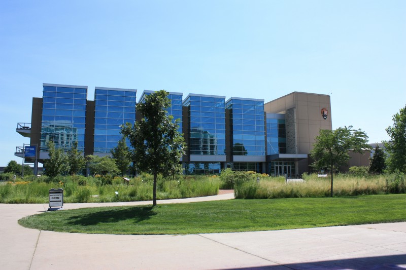
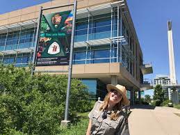
In 2004 the Regional Headquarters of the National Park Service relocated to the Riverfront, adjacent to the Bob Kerrey Pedestrian Bridge. This three story, Gold Certified LEED building houses the Park Service Regions 3, 4, 5. Its staff manages over sixty National Parks.
Later, the Park Service chose this building to house the Lewis & Clark Historic Trail Visitor Center. Today, the Visitor Center, its exhibits and Rangers, provide information regarding the Expedition and the 4,900 mile long National Historic Trail.
The Visitor Center is open to the public.
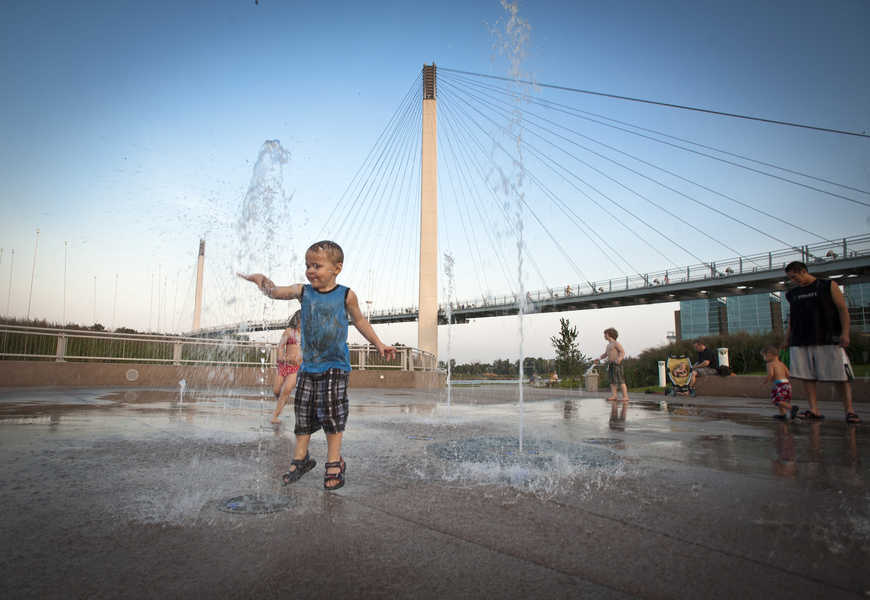
Located at the foot of the Bob Kerrey Pedestrian Bridge, this facility originally included a plaza – with a water spray park. A graded, sloped lawn, retaining walls and connector walks were added along with a display of public art. The first Riverfront BCycle station was located here. As originally hoped, the park became a popular gathering area for bridge visitors. Eventually, a stage was added to the Plaza and the walls, steps and slope became a small performance area.
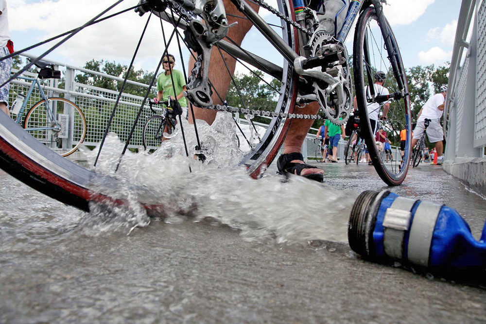
An important event for the Council Bluffs riverfront has been RAGBRAI.
Heading into its 41st year, RAGBRAI is the oldest, largest and longest recreational bicycle touring event in the world. Recently, Council Bluffs hosted RAGBRAI in 2009 and again in 2013. In 2009, RAGBRAI officials named Council Bluffs the Host Location of the Year.
The Council Bluffs riverfront is a critical element of a successful RAGBRAI experience. RAGBRAI participants from across the world have marveled at the Bob Kerrey Pedestrian Bridge and have used it to access sites and activities in Omaha. Additionally, the Tom Hanafan River’s Edge Park hosted a unique “tire dip” for the 2013 event.
The River’s Edge Pavilion, with its rooftop deck and its adjacent Water Wall, provides a civic element to the space and allows public, year-around use of Tom Hanafan River’s Edge Park. The Pavilion’s indoor space accommodates 50-60 people and has proven popular for public rentals. It’s equipped with a catering kitchen, restrooms and AV capabilities. The Pavilion’s public rooftop, also available for rent, offers breathtaking views of the park, the Missouri River and Omaha’s skyline.
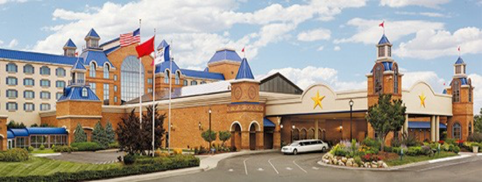
Council Bluff’s Riverfront is the home of two casinos, Ameristar and Harrahs. Located on and near the Missouri River and South of West Broadway, Casino Row earned a reputation for fun and hospitality. With the opening of Bluffs Run Greyhound Park in 1986, people were attracted to a new development area in Council Bluffs, Iowa. In the mid-1990’s, Ameristar Casino Hotel, Harvey’s (now Harrah’s) Casino Hotel, and Holiday Inn and Hampton Inn changed the face of a previously industrial area which includes the Mid-America Center, the IMAX and AMC theatres, Bass Pro, and the new Tom Hanafan River’s Edge Park. The area hotels are a big draw for conventions meetings, and gaming along the Missouri River and boast over 333 hotel rooms on the river.
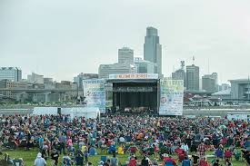
In May of 2004, Harrah’s Casino Hotel in Council Bluffs, Iowa, premiered a Vegas-style party bar in the former Mr. G’s Lounge. The new $4.5 million entertainment bar, named “Stir”, featured a multi-level interior, an outdoor terrace, an island bar, and an outdoor concert cove. The outdoor concert cove began that year with a summer concert series. By 2005, the concert cove was host to a summer music series, “Stir Up the Night”, featuring 14 bands and live music on the Stir stage. This venue continues to bring new visitors to the Riverfront area and has attracted over 55,000 concert goers annually from May-September with live nationally known bands. Harrah’s hotel is also located on the Missouri River banks with 251 rooms with breathtaking views of the river and the Omaha & Council Bluffs sky lines.
Where is the Metro’s most active outdoor concert venue? Look no further than Stir Concert Cove. The Stir Concert Series brings 20 to 25 national acts to the Iowa riverfront each year. Annual attendance totals 70,000+. Located adjacent to the Council Bluffs Dodge Riverside Golf Club and Harrah’s Casino, the Stir Concert Cove provides a summer of concerts designed to attract visitors of all ages and interests. Only on the Council Bluffs side of the Missouri River have concert goers been able to enjoy such performers as Chicago, Lorde, Dirks Bentley, Willy Nelson, the Black Crows, Mumford and Sons, and many others.
Directly across from downtown Omaha and at the foot of the newly-completed Bob Kerrey Pedestrian Bridge, the Council Bluffs Riverfront Park is a 90-acre public park situated within the broad riparian floodplain of the great Missouri River. Sasaki’s master plan for the park capitalizes upon the distinct character of the Council Bluffs side of the river—richly forested, green, and soft—in distinct contrast to the highly urbanized landscape that surrounds it.
The design of the park focuses intensity of public use and development in a core area of the existing site which allows access to the river and also preserves key habitat and riparian floodplain. Green infrastructure strategies used to increase the ecological function of the site include nearly 20 acres of reforestation, roadside bioswales, porous pavement, diverse native plantings, and parking lot rain gardens. The ecologically sensitive areas north and south of the bridge’s landing are reinforced by reforestation and wetland enhancement strategies and accessed via a series of trails and environmental interpretation.